Create Your First Project
Start adding your projects to your portfolio. Click on "Manage Projects" to get started
Foinikas Templar Village 13km Circular
Project type
Hiking
Date
4th September 2024
Location
North of Anarita, Cyprus
Route Map
Start Location
Parking is at the side of the track.
https://maps.app.goo.gl/QSfa1E5mvBR1doFE9
Physically challenging Hills.
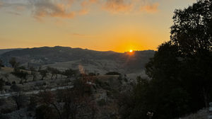
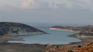
The route started with a steep descent on a wide track with loose stones and gravel. After crossing the ravine floor the route took me up a short steep hill before levelling out as it wound along the side of the reservoir. A track on my right took me down to the templar village which then looped back on to the main track. Continuing on past the village I came to the end of the reservoir and joined a flat wide track covered with pebbles initially. After a further KM there was a left turn with orchards. At the next intersection the route took a sharp left and almost came back on itself. This is where the climb started. I could see the route ahead of me. The steep climb was worth it, the views from the top of the cliff are fabulous. I got to the top at sunrise.
The route continued on wide tracks with some down hill and uphill sections. At one point on a descent I had turn off the wide track just after an electricity pylon. The turning didn't look like a track, it resembled a ploughed field. However I followed the route map across the ploughed section and then dropped down a steep slippery slope (loose surface) section down on to a wide track again. This section was tricky and did not look like a track at all. I followed this track to the valley floor and then along before turning left on to a tarmac road. The road gradually headed up hill past the army training area and barracks. Then turning left I headed on wide tracks back to the start point.


