Create Your First Project
Start adding your projects to your portfolio. Click on "Manage Projects" to get started
Kouklia 7KM Circular
Project type
Hiking
Date
23rd September 2024
Location
Kouklia, Cyprus
Start Location
Dirt parking area
https://maps.app.goo.gl/e2MQXfrGw9Bsn6216
Route Map
Nearby Taverna's
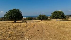
The start location was the dirt parking area below the Church of Panagia Katholiki. The route took us up the main road and we turned right at the top and then head down to the left and then turned right again. We then headed out of the village on a wide track that climbed gently for 4KM. It levelled off and headed round to the left past a goat farm, at the road we turned right. The route was on tarmac for 400M before heading off on a left turn back onto a dirt track. This track gently increased in elevation for a KM.
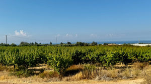
Then the route took a left turn and we followed another track that wound its way through the fields and trees. Finally ending up with a right turn on the track that finally led back to Kouklia village, past orange orchards and pomegranate trees. There was a small steep hill at the end before the village, after which it was down hill.


