Create Your First Project
Start adding your projects to your portfolio. Click on "Manage Projects" to get started
Nata_Old Choletria 7KM Circular
Project type
Hiking
Date
31st October 2024
Location
Nata, Cyprus
Route Map
Start Location
There was limited parking at the beginning but I could have adjusted the start location if I wanted. The route took me down a gentle winding road to a flat river valley. This valley was at the top end of the Asprokremmos Reservoir. I reached an intersection with a wide track and turned left up the flat river valley. The surface was loose but fairly good. I followed the river valley track to where it met a road. Then turned right across the bridge and then left back on to a track as I left the bridge. Approximately 3.3km into the walk there was a small elevation and a bend, then the route continued up the valley.
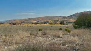
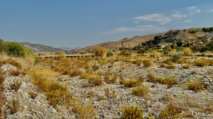
At approximately 4.3KM the route took me across the river bed. The route wasn't obvious and in winter you could get wet feet. It was dry when I did it. I had to adjust the route on the map as the crossing wasn't where it was indicated. It was another 100m or so further up the valley.
When I looked across the river bed, I couldn't see where the route went. In fact it appeared to be a dead end. It didn't become apparent till I had crossed the river bed.
Once across the river the route took me to the left and then wound to the right. I couldn't see the route from a distance it's misleading. It opened as I went along.
I have added pictures of the river bed and crossing.
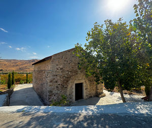
I then found myself turning left on to a quiet road 4.6KM into the walk. The next 2KM's were relatively flat, the road followed the river valley back to Nata. I passed a Taverna and a Church.
At 6.6KM the route started up hill for 0.5KM and the elevation increased 28M. At the top I went left back down to the start point.


